
Southern Afar Rift
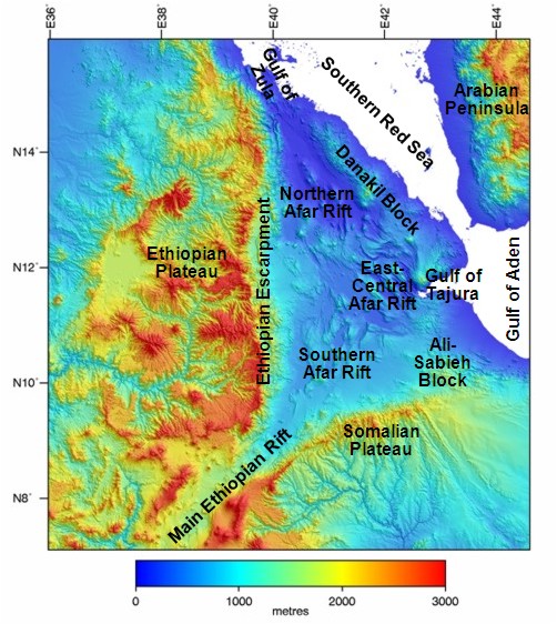
Digitial elevation map of the Afar region showing the main structural divisions.
Geology of the Southern Afar Rift
The Southern Afar Rift is bound by the Somalian Escarpment in the south, the Ali-Sabieh Block in the east, the Tendaho–Gobaad Discontinuity in the north and the Main Ethiopian Rift to the west Figure 2. In the west the dominant structural trend is north to northeast whilst to the east it is more east-west (Beyene & Abdelsalam, 2005). The Southern Afar Rift system is about 250km long with an average crustal thickness of about 26km. Plio-Pleistocene flood basalts are cut by narrow NNE-SSW trending Quaternary basins. Northwest-trending transfer fault zones between the basins can be traced to discontinuities in the western Ethiopian Escarpment (Hayward & Ebinger, 1996). Between the basin flanks and the Escarpment, a distance of more than 50km, are essentially unfaulted Pliocene – Recent (3.3-0Ma) fluvio-lacustrine sediments and basalts (Varet, 1978).