
How magnetotellurics works
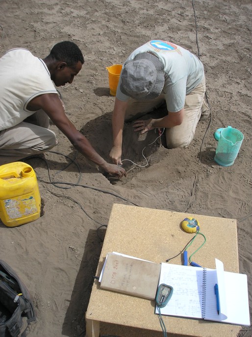
The magnetotelluric equipment is so sensitive even a gust of wind could affect the readings, so it needs to be buried.
Hunting for magma with magnetotellurics
Just like metal objects buried in the ground, molten magma in the Earth’s crust is highly electrically conductive. This means it can be detected with what is essentially a massive metal detector. This method of looking deep into the Earth’s crust to study its conductivity is called magnetotellurics and it involves making measurements of the Earth’s natural magnetic and electric fields at the surface of the Earth.
MT equipment requires an area of soil or sand of approx 100 x 100 m in which the sensitive instruments can be buried. This can be a problem in the rocky rift. First, electrodes are buried in the ground about 100 m apart in a north-south/east-west cross (right). Then each is connected to a computer at the centre of the cross. Now sensors known as coils which measure the Earth’s magnetic field are also buried in the ground: one in a north-south direction and the other aligned east-west. These are also connected to a computer which records the continuously changing magnetic and electrical fields for several days.
The data gathered allow the conductivity of the Earth’s crust to be calculated down to 40km below ground level. The molten rock or magma shows up as a high conductivity anomaly just like a lump of metal would.
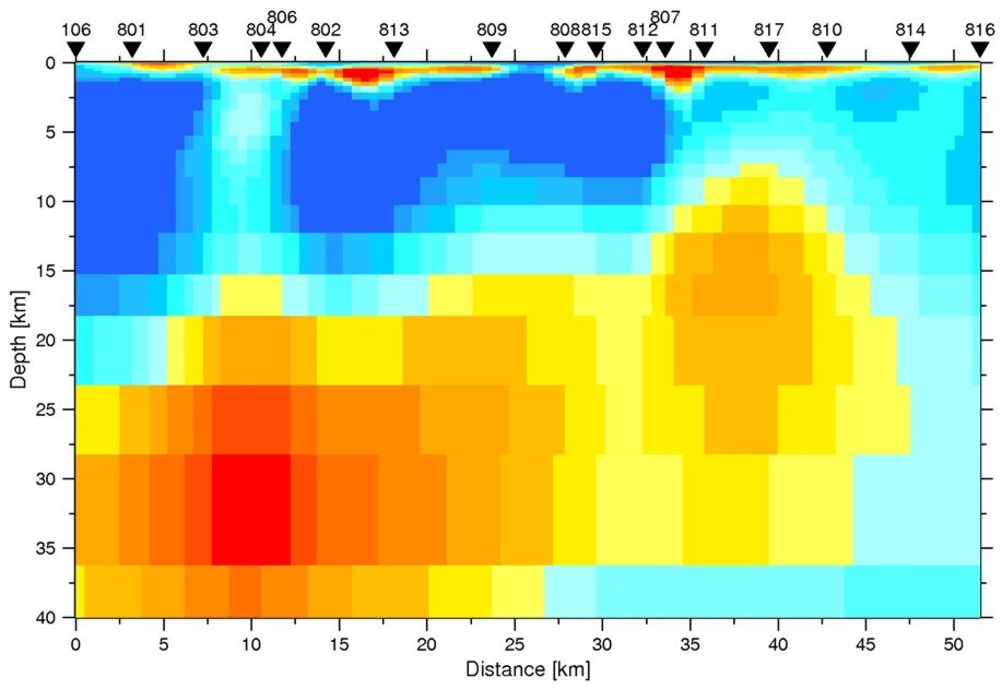
An image through the Earth's crust showing its electrical conductivity. The reds and yellows are regions of high conductivity and represent two magma chambers.